Landmark: Shire River Gorges
City: Blantyre
Country: Malawi
Continent: Africa
Shire River Gorges, Blantyre, Malawi, Africa
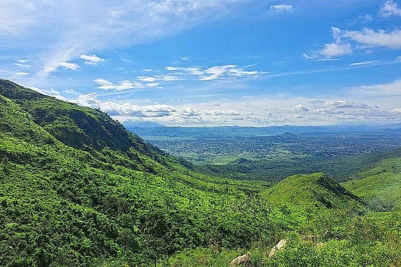
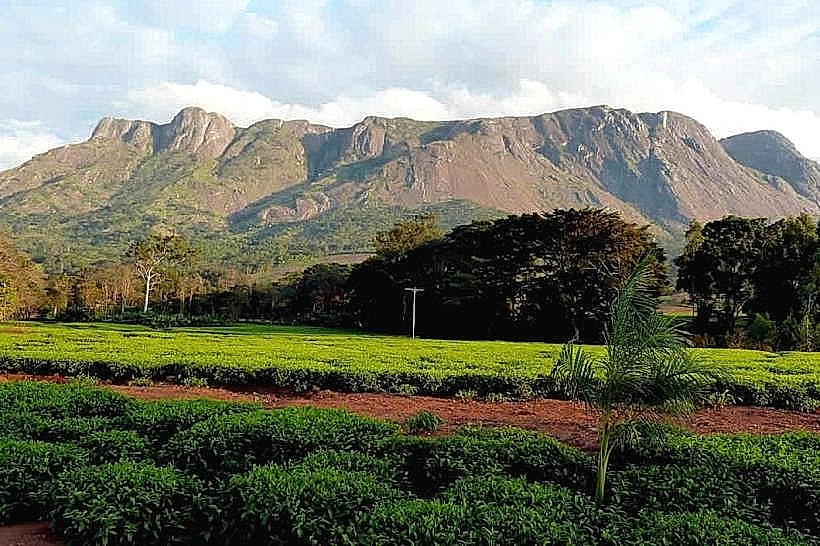
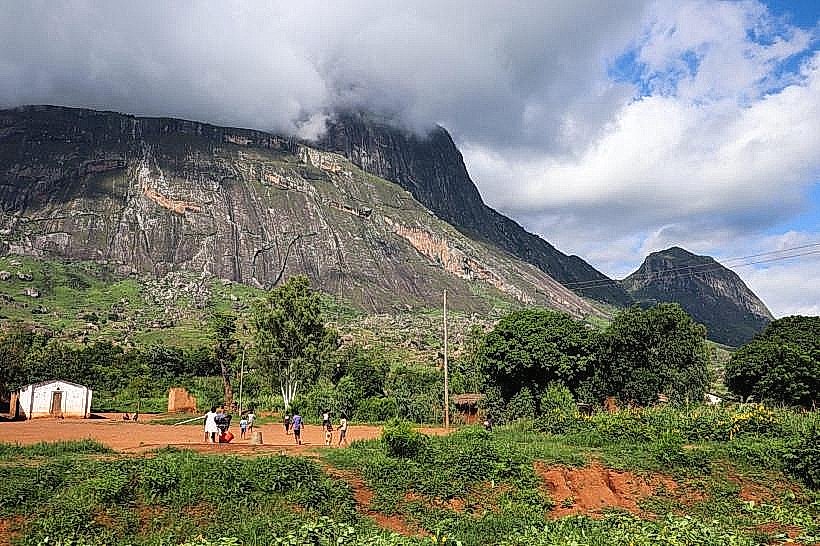
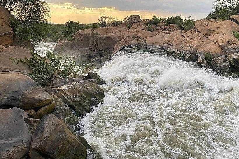
The Shire River Gorges comprise a dramatic, high-energy hydrological corridor and geological feature located in the middle section of Malawi’s largest river. Spanning approximately 80 kilometers between Matope and Chikwawa northwest of Blantyre, this rugged middle valley acts as the steep descent mechanism where the river drops 384 meters over basalt steps and fault lines to transition from the upper plateau into the Lower Shire Valley floor.
Visual Characteristics
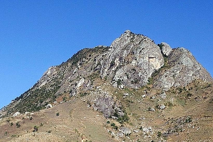
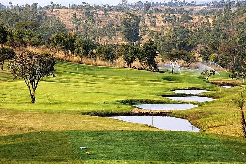
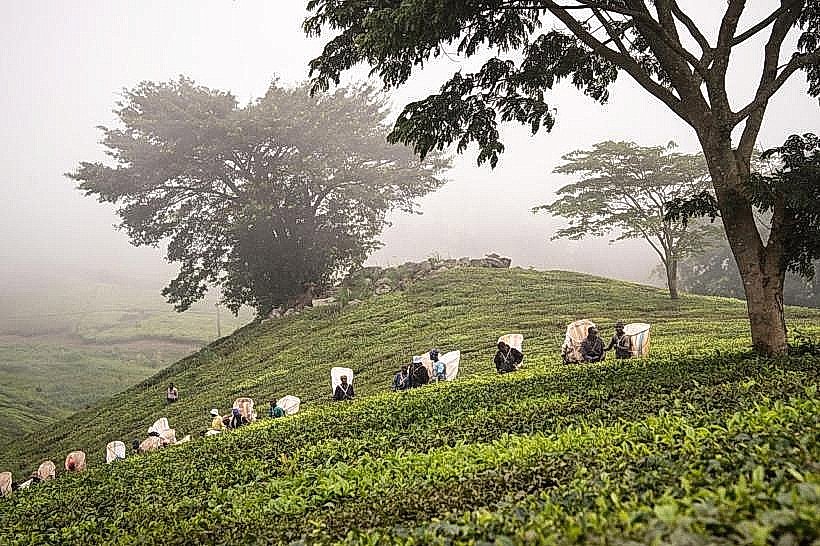
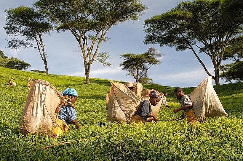
The landscape is defined by deep, narrow V-shaped stone ravines, jagged metamorphic rock outcroppings, and turbulent whitewater rapids. The river channels are highly constricted by dark grey Precambrian granulite walls, forcing the high-volume flow to crash successively over massive rock benches. The topography alternates between sheer cliff faces and steep, boulder-strewn hillsides covered in resilient miombo woodland, thorny acacia brush, and pale-barked star chestnut trees. The infrastructure is characterized by large-scale engineering works, including reinforced concrete hydroelectric dams, heavy intake towers, and massive high-voltage transmission lines cutting through the wild gorge scenery.
Location & Access Logistics
The gorges track through a rugged, isolated territory distributed across the Blantyre, Neno, and Chikwawa districts. The northern and central sectors-encompassing the Nkula and Tedzani infrastructure zones-are reached via the paved M1 north highway from Blantyre, branching west at Zalewa or Matope onto dedicated asphalt and gravel utility tracks. The southernmost point at Kapichira Falls is accessed via Chikwawa by driving south from Blantyre on the M1, descending the escarpment, and navigating west through the main entrance of Majete Wildlife Reserve along well-graded gravel roads. While the primary power station access points are passable for standard two-wheel-drive vehicles, exploring the unmanaged wilderness sections or minor canyon tracks strictly requires a high-clearance four-wheel-drive vehicle. Public transit options are restricted to minibuses running the Blantyre-Zalewa axis, from which private motorcycle taxis must be contracted to navigate the final 10 to 15 kilometers of rural roads to the canyon edges.
Historical & Ecological Origin
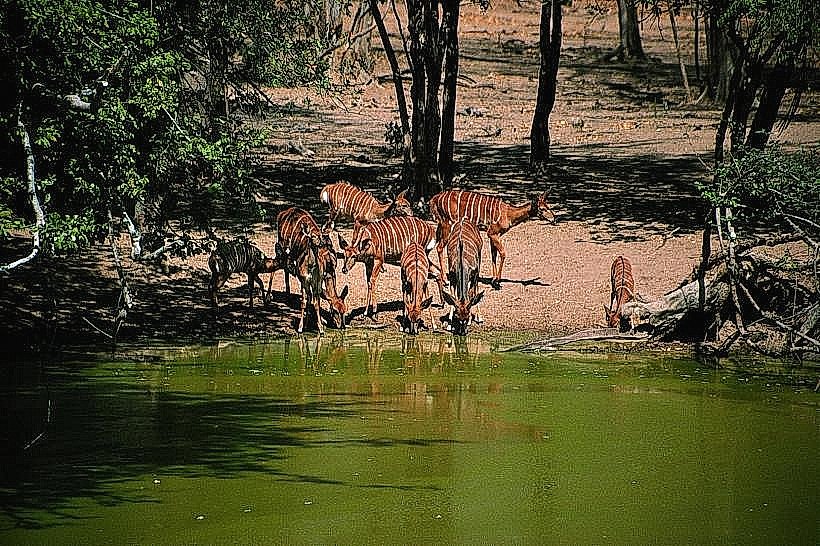
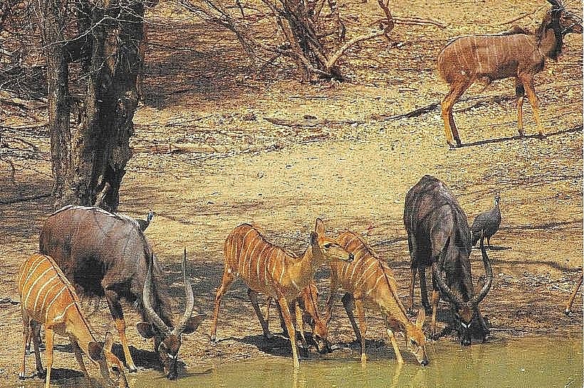
Geologically, the gorges represent a series of fault-controlled step-fault fractures formed by the ongoing tectonic extension of the East African Rift System. The roaring rapids were historically documented in 1859 by the British explorer Sir David Livingstone during his second Zambezi expedition; his advance upstream via steamship was permanently halted by the impassable cataracts, which he named the Murchison Cataracts in honor of geologist Sir Roderick Murchison. Recognizing the vast kinetic potential of this 384-meter drop, the post-independence Malawian government systematically harnessed the middle valley, constructing the Nkula Dam, Tedzani Dam, and Kapichira Hydroelectric project to supply over 90 percent of the nation's domestic electrical grid. Ecologically, the Southern sectors are preserved within the 700-square-kilometer Majete Wildlife Reserve, protecting a vital riverine forest basin and critical aquatic habitats.
Key Highlights & Activities
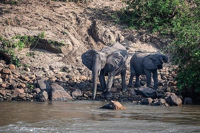
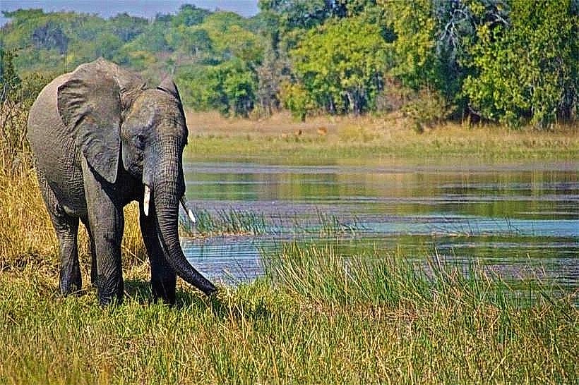
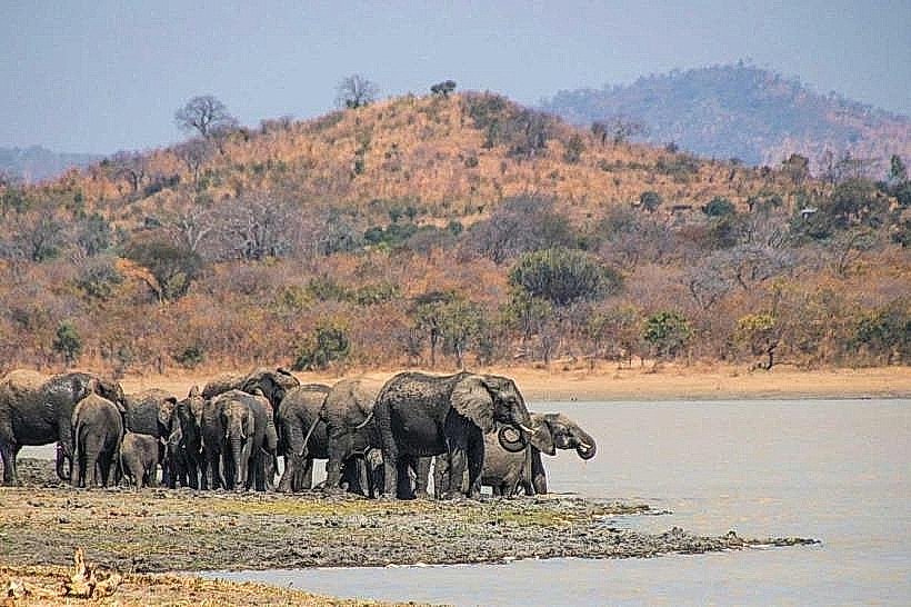
Industrial and mechanical sight-seeing is centered around authorized view platforms overlooking the primary engineering structures, where visitors can observe the massive volumes of water channeled through the spillways of the Nkula and Tedzani stations. Within the secure borders of Majete, visitors can complete guide-led walking safaris along the Mkulumadzi and Shire river confluences to inspect spectacular sedimentary and metamorphic patterns scoured into the rock beds over thousands of years. Wildlife viewing along the canyon margins allows for tracking large pods of hippopotamuses, basking Nile crocodiles, and elephant herds descending the steep slopes to drink. Birdwatching is highly active along the rocky rapids, hosting specialists like the rock pratincole, Pel's fishing owl, and the African fish eagle.
Infrastructure & Amenities
The developed sectors of the gorges are tightly bound to state-managed industrial installations, meaning public access inside the direct power station perimeters is heavily restricted and requires prior clearance from the Electricity Generation Company (EGENCO). Visitor infrastructure is highly advanced inside the southern Majete sector, which features the luxury Mkulumadzi Lodge, the off-the-grid Mwembezi Gorge Bush Camp, and public restroom blocks at the main park welcome center. Shade is abundant within the deep riverine tree belts lining the canyon bottoms, while the upper rocky cliffs are starkly exposed to intense solar radiation. Mobile cellular connectivity is variable; powerful 4G and 5G network signals are generated around the primary hydroelectric installations and the Majete gate, but the deep, narrow interior stone trenches suffer from total signal isolation.
Best Time to Visit
The optimal window for landscape photography, rock inspection, and safe transit occurs during the dry winter season from May to August, when ambient temperatures remain comfortable between 18 and 24 degrees Celsius and atmospheric haze is minimal. Morning hours from 07:00 to 10:00 provide optimal lighting angles that illuminate the deep rock channels without generating the intense glare and heat common by midday. The wet summer season from November to April introduces heavy tropical storms that dramatically increase the river's discharge rate, creating awe-inspiring flood displays over the spillways but rendering the dirt roads along the unmanaged canyon rims slick, muddy, and dangerous.
Facts & Legends
A tragic historical landmark situated near the Kapichira sector of the gorges is the grave of George Thornton, a young geologist who served on David Livingstone’s 1859 expedition and succumbed to blackwater fever amid the harsh climatic conditions of the middle valley. Local engineering records underscore the intense vulnerability of the gorge infrastructure to climate events: in January 2022, the extreme deluge from Tropical Cyclone Ana generated an unprecedented flash flood down the narrow rock channels, completely submerging the main intake structures at Kapichira and temporarily cutting off a massive portion of the national power supply, prompting intensive multi-year reconstruction operations to restore the grid.
Nearby Landmarks
Mpatamanga Gorge Bridge – 0.5km Central
Kapichira Hydroelectric Dam & Falls – 1.2km South
Mkulumadzi River Confluence – 2.4km South-Southwest
Majete Wildlife Reserve Entrance Gate – 4.5km South
Chikwawa Administrative Boma – 16.0km Southeast