Landmark: Mwabvi Wildlife Reserve
City: Blantyre
Country: Malawi
Continent: Africa
Mwabvi Wildlife Reserve, Blantyre, Malawi, Africa
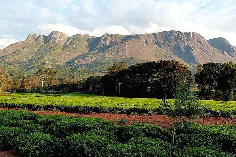
Mwabvi Wildlife Reserve is a remote protected wilderness area that stands as the smallest national game reserve in Malawi. The reserve encompasses 135 square kilometers of rugged, low-density bushveld in the far southern tip of the country within the Nsanje District, positioned in the lower reaches of the Shire River Valley along the international border with Mozambique.
Visual Characteristics
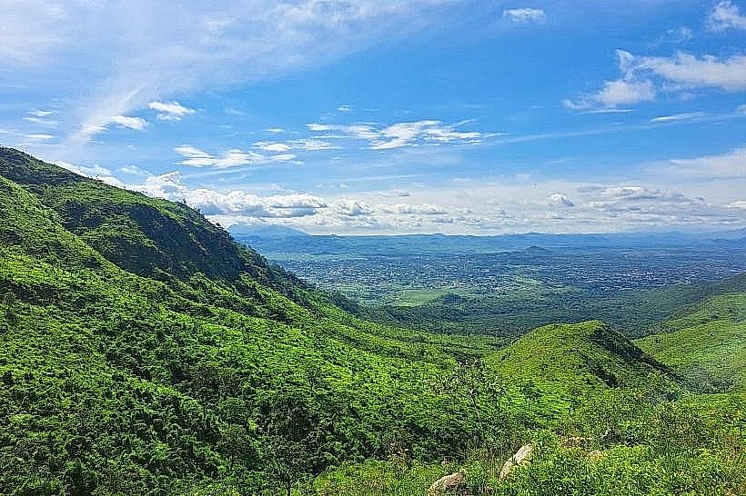
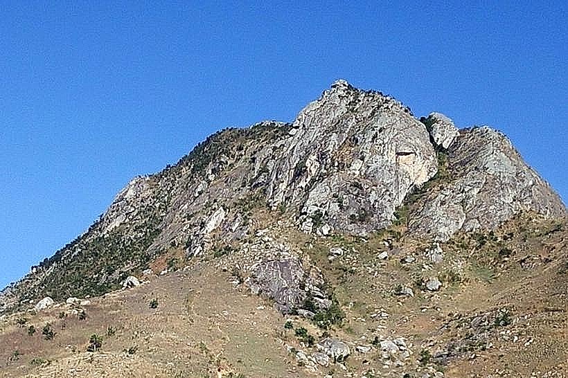
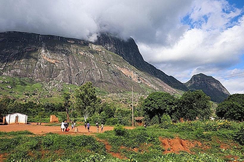
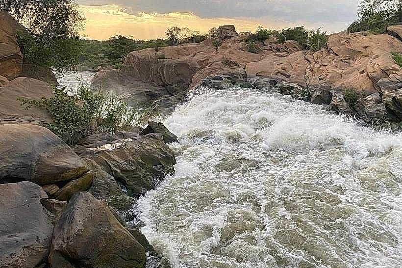
The landscape is characterized by an arid, low-altitude basin dominated by spectacular, weathered sandstone outcrops and sheer rocky cliffs that impart a distinct lunar aesthetic to the terrain. The topography contains a portion of the Matandwe Range, dropping down to seasonal sand rivers and deep stone gorges. The vegetation profile is unique within Malawi, featuring extensive tracts of nationally endangered mopane woodland alongside dry Combretum and Brachystegia miombo biomes, open savanna grasslands, and specialized dambo wetlands. The overall color palette is characterized by dusty ochre earth, silver-grey sandstone faces, and the pale greens of the specialized dry-zone forest canopy.
Location & Access Logistics
The reserve is situated approximately 130 kilometers south of Blantyre and 50 kilometers south of Chikwawa town. Private vehicles access the territory by traveling south from Blantyre along the paved M1 highway through the Lower Shire Valley, branching west onto unpaved, deeply rutted dirt tracks south of Bangula. Due to the complete absence of developed park roads, steep sandy riverbeds, and severe erosion along the approach lines, a high-clearance four-wheel-drive vehicle equipped with off-road recovery gear is strictly required for all internal movement. Public transit options are limited to boarding a long-distance minibus from Blantyre to Nsanje or Bangula, disembarking at the rural Mwabvi junctions, and contracting a private local motorcycle taxi to traverse the final, rugged 15 to 20 kilometers of wilderness tracks to the primary Department of National Parks and Wildlife (DNPW) base.
Historical & Ecological Origin
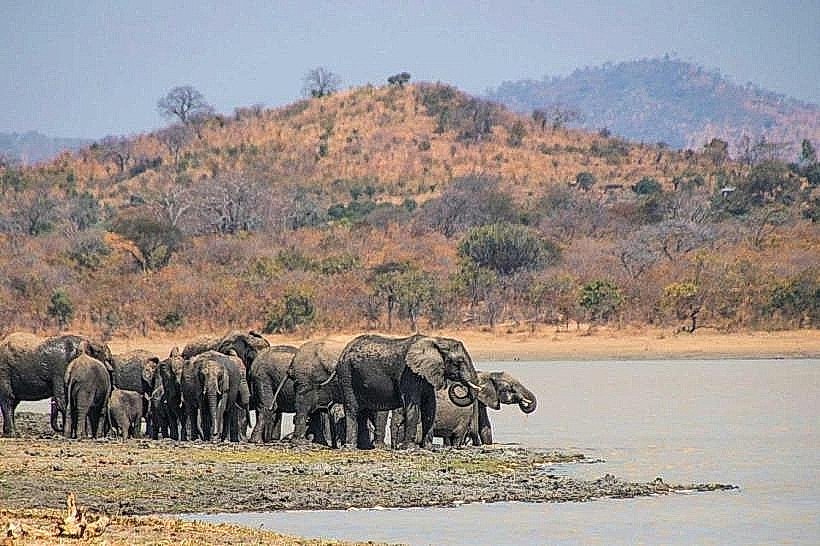
The conservation zone was originally founded in 1928 as the Thangadzi Game Reserve, established primarily to protect the region's unique thicket ecosystems and a pocket of black rhinoceros. The territory was expanded and formally gazetted under its current title in 1953, with subsequent boundaries adjusted in 1975 to achieve its current 13,500-hectare layout. Historically, Mwabvi hosted the absolute last native population of black rhinoceros in Malawi, which ultimately became extinct locally between 1989 and 1992 due to intense cross-border commercial poaching and political instability in the region. The reserve is adjoined to the 28,000-hectare Matandwe Forest Reserve, forming a joint transboundary ecological corridor linked to the South East Africa Montane Archipelago ecoregion.
Key Highlights & Activities
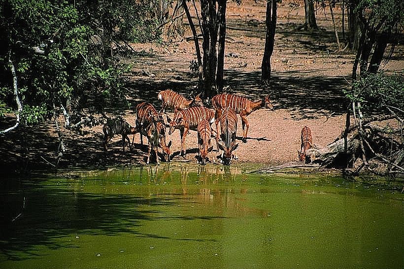
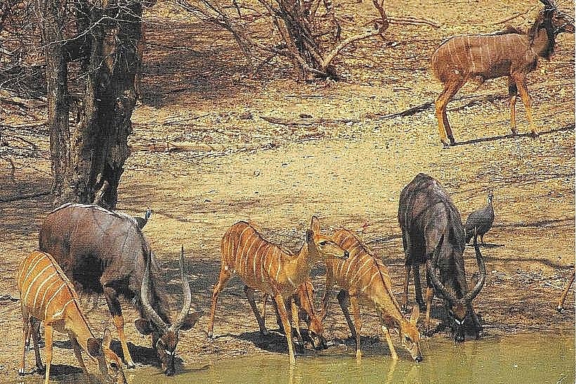
Trekking on foot accompanied by armed wildlife scouts represents the primary mode of exploration due to the impassable nature of the internal vehicle tracks. Key geographical focal points include the Mwabvi Gorge on the Mwabvi River-historically named Ndipitakuti (meaning "where do I go from here?") due to its sheer, dead-end stone walls-and the Nkhangane rock protrusion, a massive, steep-sided stone massif containing numerous natural caves, recesses, and prehistoric rock overhangs. Birdwatching is highly active, with the reserve serving as a globally recognized Key Biodiversity Area that hosts over 270 recorded avian species, including the northernmost populations of Rudd's apalis and Woodward's batis, as well as being the only protected habitat in Malawi for the double-banded sandgrouse.
Infrastructure & Amenities
The reserve operates as a highly neglected "paper park" under a low-intervention framework, lacking formal visitor centers, maintained interpretive centers, or public utilities. Basic stone campsites and remnants of older community-run eco-lodges exist near the main gates, providing rustic clearings but requiring visitors to be completely self-sufficient. Continuous shade is restricted to the narrow margins of the riverine forests and beneath large mopane stands, while the sandstone ridges are fully exposed to extreme heat. Mobile network signals are exceptionally weak, with highly unstable 4G network tracking limited to the highest rock protrusions near the Mozambique border, while 5G infrastructure is entirely non-existent. There are no commercial fuel, food, or water supply points within a 40-kilometer radius, requiring all self-drive expeditions to haul extensive independent provisions from Blantyre.
Best Time to Visit
The optimal period for wilderness foot trekking and structural landscape photography corresponds with the dry winter months from June to September, when regional daytime temperatures remain manageable between 20 and 26 degrees Celsius and the thin vegetation improves visibility through the mopane woodland. Morning movements between 06:00 and 09:30 are mandatory to avoid the extreme afternoon thermal spikes characteristic of the low-altitude Shire basin. The wet summer season from November to April introduces intense, stifling tropical heat, dense thorn undergrowth, and seasonal flash floods along the sand rivers that render the entire reserve completely inaccessible to outside transit.
Facts & Legends
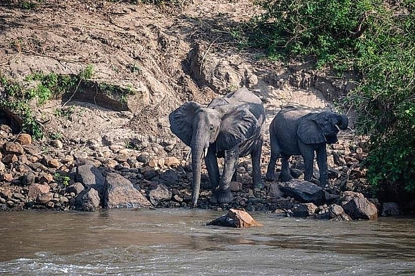
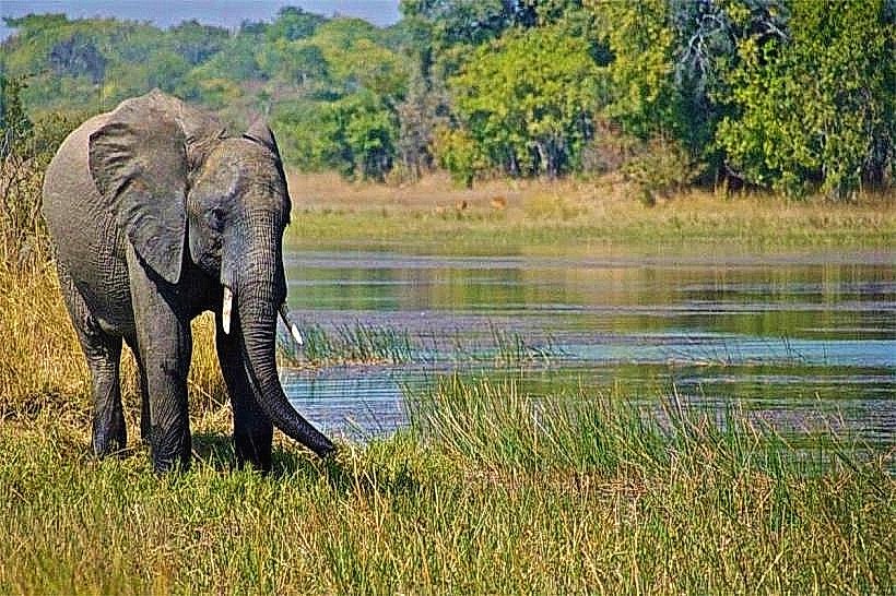
The park derives its name directly from the native Mwabvi tree (the forest ordeal tree, Erythrophleum suaveolens), an indigenous hardwood species whose highly toxic bark extract was historically utilized by regional traditional authorities in ancient judicial trials by ordeal to determine guilt or innocence. While heavy historical poaching completely extirpated the reserve's populations of lions, elephants, and rhinos, leaving the Cape buffalo as the sole remaining representative of the "Big Five," local rangers document that wide-ranging lions from neighboring wilderness zones in Mozambique still cross the porous international boundary markers to hunt within the reserve's interior sandstone valleys.
Nearby Landmarks
Mwabvi River Sand Gorges – 0.5km West
Matandwe Forest Reserve Boundary – 0.1km South
Nkhangane Rock Caves – 3.4km West
Mozambique International Border – 6.2km West
Elephant Marsh Ramsar Site – 24.0km Northeast