Landmark: Malape Pillars
City: Zomba
Country: Malawi
Continent: Africa
Malape Pillars, Zomba, Malawi, Africa
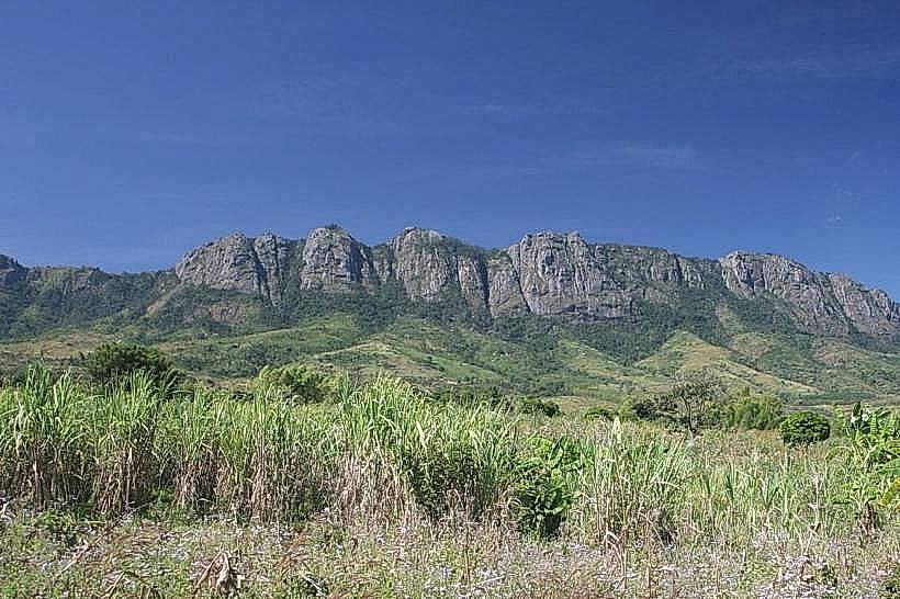
The Malape Pillars, also referred to as the Chikala Pillars, are a collection of rare geological structures located at the base of the Chikala Hills in southern Malawi. The formation sits within the Machinga District, approximately 35km north of Zomba city center and roughly 15km southeast of Liwonde township.
Visual Characteristics
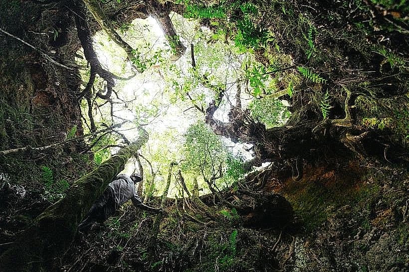
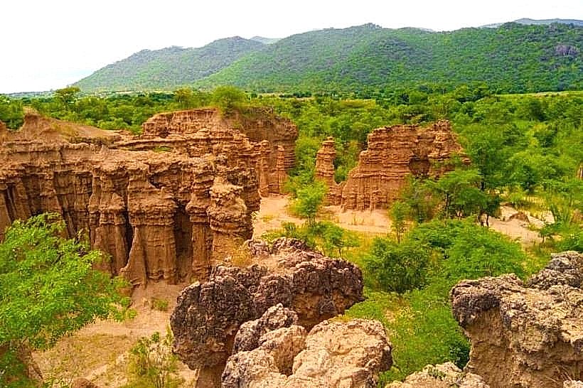
The landmark comprises a network of vertical, fluted earthen columns, spires, and pinnacles sculpted from compacted sandstone, grit, and clay. These pillars reach varying heights up to several meters, presenting colors that range from light tan and beige to deep reddish-brown depending on the moisture content of the soil layers. The tops of many pillars are capped by harder rock fragments or mineral crystals that shield the underlying columns from vertical rain impact. The formations are situated within a localized canyon structure surrounded by Brachystegia woodlands, blue gum plantations, and scattered patches of low-lying montane brush.
Location & Access Logistics
The primary route to the pillars begins from the M3 road at the Mpotola Trading Centre, located about 12km from Liwonde towards Ntaja. From Mpotola, a dirt track heads east for 5km toward Chindenga Village (Group Headman Chindenga, T/A Nsanama). This unpaved track features a small wooden bridge over a stream that often becomes impassable for standard vehicles during wet periods, requiring high-clearance four-wheel-drive transport or a bicycle transfer. Visitors park their vehicles at Chindenga Village after paying a community fee to the local chief. An alternative, more strenuous 4x4 route approaches from the Malosa Forestry Station near the Malosa Army Base, requiring a long downward hike through steep terrain and shallow streams. No formal public transit lines access the village or the canyon directly.
Historical & Ecological Origin
The pillars were formed via accelerated differential water erosion acting upon sedimentary deposits at the foot of the granitic Chikala Hills range. Rainwater systematically washes away the surrounding unprotected soft soils, while isolated patches of harder surface crystals or stone caps protect the specific columns of grit directly underneath them. Historically, the remote site was documented in the early 20th century by naturalist Hans Coudenhove in his 1925 publication "My African Neighbours," which recorded his isolated residence in a cedar-lined dwelling nearby.
Key Highlights & Activities
Foot exploration and scrambling through the narrow sandstone gorges and alcoves-locally referred to as "chapels"-constitute the primary activities. Landscape photography is popular due to the sharp shadows and textures created by the geometric fluting of the spires. Cultural walking tours are conducted by village guides who provide details on local geographical features and community history.
Infrastructure & Amenities
The landmark operates as an undeveloped community-managed heritage site with no commercial infrastructure. There are no public restroom facilities, constructed shade pavilions, electricity grids, or formal trash disposal systems at the canyon or the parking area. No food, beverage, or equipment vendors exist on-site, requiring visitors to carry independent water and supplies. Cellular network signals (4G) are weak and highly unstable within the lower recesses of the canyon formations.
Best Time to Visit
The most favorable months for visitation are from May to October during the dry season, which eliminates the logistical risk of mud and flooding along the village access tracks and stream crossings. The early morning and late afternoon hours provide optimal directional sunlight for photography, accentuating the deep contours and colors of the sandstone columns. Visited conditions between November and April are hazardous due to slippery clay terrain and rapid water runoff that accelerates the degradation of the fragile structures.
Facts & Legends
The name Malape originates from a Yao and Chichewa linguistic root meaning "startling" or "causing wonderment." Local oral traditions associate the canyon with spiritual occurrences, including historical accounts of invisible choruses singing from the spires, disappearing figures, and unguided acoustic phenomena within the recesses. A critical visitor tip is to avoid leaning against or climbing directly onto the pillars, as the sandstone material is brittle and highly susceptible to structural collapse.
Nearby Landmarks
Chikala Hills Crest – 2.1km North
Machinga Likwenu River – 3.8km West
Malosa Forest Reserve Boundary – 4.2km Southwest
Mpotola Trading Centre – 5.0km West