Landmark: Mulunguzi Dam
City: Zomba
Country: Malawi
Continent: Africa
Mulunguzi Dam, Zomba, Malawi, Africa
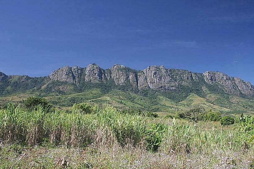
Mulunguzi Dam is an artificial reservoir located on the southern upper slopes of the Zomba Massif in southern Malawi. It is situated within the Zomba District, roughly 3.8km north of the center of Zomba city.
Visual Characteristics
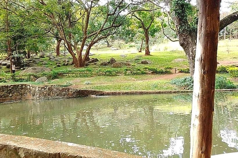
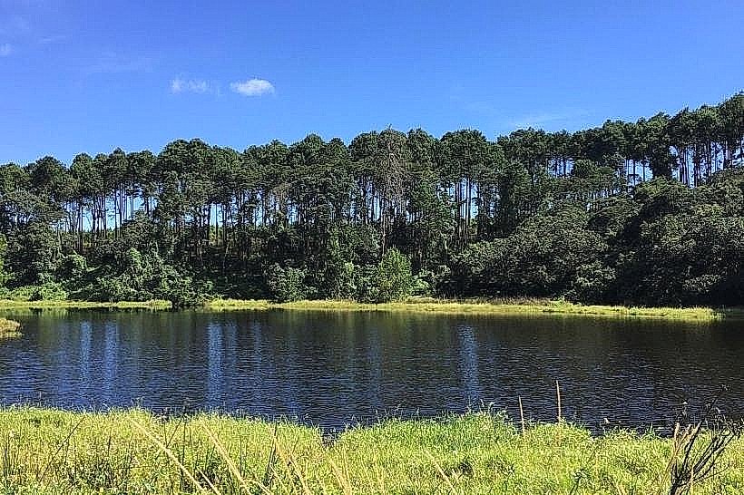
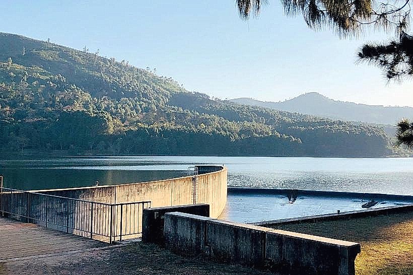
The landmark features a wide, modern earth-fill embankment dam structure stretching across the Mulunguzi River valley. The reservoir contains a surface capacity holding approximately 3.4 million cubic meters of water, appearing as a broad, calm lake that reflects a deep blue or gray-green color depending on sky conditions. The shoreline is bordered by open grassy clearings, picnic grounds, and dense stands of Mexican pine (Pinus patula) and indigenous Malawian cedar trees. On the eastern edge of the masonry structure, a concrete side-spillway with a 50m crest length is visible, designed to channel overflow during extreme weather events.
Location & Access Logistics
The dam is accessed from Zomba city center by taking the paved, winding Up Road ascending the Zomba Plateau for roughly 4km toward the Sunbird Ku Chawe hotel area. Near the top entrance barrier and forestry office, travelers turn onto the unpaved access roads leading directly to the water catchment area. While the main approach is accessible by standard vehicles, the immediate perimeter dirt tracks are rough and best negotiated via high-clearance vehicles. Pedestrians can access the site via the steep "Potato Path" hiking trail, a 45-minute uphill trek commencing near the base of the mountain. No public minibuses traverse the upper plateau road directly to the dam gate.
Historical & Ecological Origin
Construction on the current enlarged dam structure began in June 1997 and was officially opened in August 2000 under the First National Water Development Project, heavily funded by the World Bank. Built by the Government of Malawi, its primary purpose was to resolve severe seasonal water shortages by providing a reliable clean water source for over 100,000 residents in Zomba and surrounding rural plains. Ecologically, the project location was specifically altered during the planning stages in the mid-1990s to protect and preserve the delicate, localized micro-habitat of a rare endemic species of butterfly thriving in the montane forest.
Key Highlights & Activities
Foot travel and casual walking are popular along the wide crest of the dam wall, which charges a nominal entry fee collected by the southern region water authorities. The grassy banks on the far side of the reservoir function as dedicated picnic and barbecue grounds for day visitors. The reservoir serves as a major trailhead hook for wilderness hikes heading upstream toward the nearby river cascades or outward along forestry tracks.
Infrastructure & Amenities
The site possesses basic, low-intensity visitor infrastructure including cleared dirt parking spaces and designated grassy picnic clearings. There are no built public restroom facilities, permanent shade structures, or electricity hookups along the waterfront. No formal food or equipment vendors operate at the dam site, requiring visitors to carry their own provisions. Cellular signal strength (4G) is functional but variable across the open water body, occasionally fading near the steep forest margins.
Best Time to Visit
The most favorable months to visit are between May and October during the cool, dry winter season when walking paths are clear and the access tracks are entirely dry. The early morning hours offer optimal conditions for landscape photography, providing still water conditions for forest reflections before afternoon mountain winds generate ripples on the surface. The rainy season from November to April brings high water volumes and dramatic spillway action but compromises road accessibility due to heavy mountain mist and slick clay soils.
Facts & Legends
A verified historical oddity surrounding the dam involves its initial environmental standoff in 1985, where international biologists successfully halted early engineering blueprints for over a decade to protect the mountain's unique entomological biodiversity. Local tip: A quiet walk near the marshy fringes where the Mulunguzi River drains into the reservoir provides regular opportunities to view specialized high-altitude avifauna and rare mountain frogs that remain undisturbed by the deep open water.
Nearby Landmarks
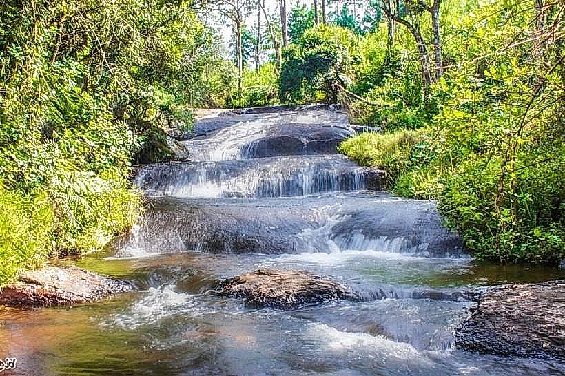
Williams Falls – 1.1km Northwest
Mandala Falls – 1.6km Northwest
Sunbird Ku Chawe – 1.9km West
Chagwa Dam – 2.1km North
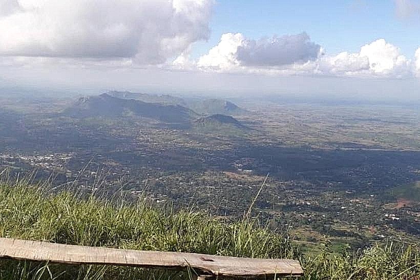
Emperor's View – 3.4km Northwest