Landmark: Zomba Plateau
City: Zomba
Country: Malawi
Continent: Africa
Zomba Plateau, Zomba, Malawi, Africa
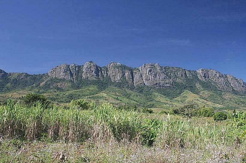
The Zomba Plateau, also known as the Zomba Massif, is a massive granitic mountain plateau and state-protected forest reserve in the Southern Region of Malawi. The plateau covers approximately 130 square kilometers, rising sharply above the historic former colonial capital city of Zomba to form a prominent highland shield on the eastern edge of the Shire Rift Valley.
Visual Characteristics
The landmark features a tabular, table-mountain structure with an expansive, relatively flat upper surface hovering at an altitude of approximately 1,800 meters, culminating at Mulumbe Peak at 2,087 meters above sea level. The perimeter is defined by sheer, near-vertical granite and syenite cliffs that drop up to 1,200 meters to the plains below. The landscape is dominated by a dense, structural canopy of non-native Mexican pine (Pinus patula) plantations, interspersed with remnant pockets of indigenous afromontane cloud forests, giant Mulanje Cedars, and clear alpine streams. The interior features deep valley fractures holding freshwater dams and cascading waterfalls that tumble over smooth granite boulders.
Location & Access Logistics
The plateau is located approximately 60 kilometers northeast of Blantyre and sits directly adjacent to Zomba city. Private vehicles access the upper rim via an all-weather, paved tarmac engineering road that climbs steadily from the base city up the southern slopes; a dedicated "down road" creates a one-way traffic loop around the steepest ascents. The main service paths running across the top to the primary trailheads consist of well-graded gravel and dirt tracks passable for standard two-wheel-drive vehicles during dry periods. Public transit commuters can utilize any high-frequency minibus from Blantyre to the central Zomba town terminal and contract a registered local taxi or a motorcycle taxi at the mountain base to traverse the 30-minute winding climb to the top.
Historical & Ecological Origin
Geologically, the massif is composed of an ancient granitic syenite pluton-a massive igneous intrusion that forced its way into older metamorphic rock layers during the late Jurassic and Cretaceous periods before being exposed by regional tectonic uplift and extensive differential weathering. To secure the critical municipal watershed for the surrounding lowlands, the British colonial administration formally gazetted the territory as the Zomba and Malosa Forest Reserves in 1913. The plateau forms part of the proposed South East Africa Montane Archipelago (SEAMA) ecoregion, protecting isolated biological "sky islands" that host unique micro-habitats, though centuries of commercial timber operations have heavily modified the original montane grasslands into softwood forestry zones.
Key Highlights & Activities
Trekking and trail hiking form the primary recreational framework across a vast network of marked pathways. Key geographic highlights include:
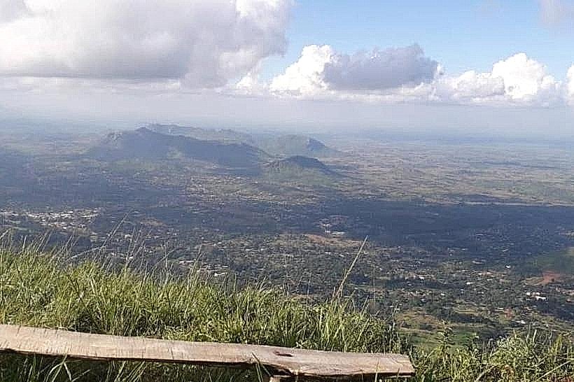
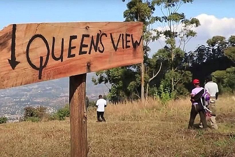
Queen’s View and Emperor’s View – Two iconic, short-walk cliff lookouts providing panoramic vistas over Zomba town, the Phalombe Plains, Lake Chilwa, and the distant Mount Mulanje massif.
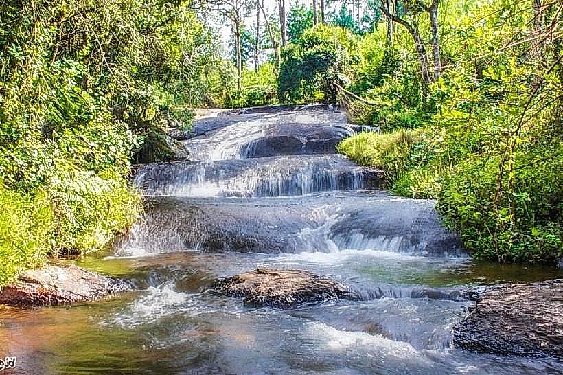
Williams Falls and Mandala Falls – Picturesque forest cascades that tumble into shallow granite basins along the Mulunguzi nature trail loop.
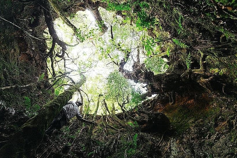
Chingwe’s Hole – A deep, 457-meter vertical sinkhole steeped in local tribal legends, located near the western rim overlooking the Shire River channel.
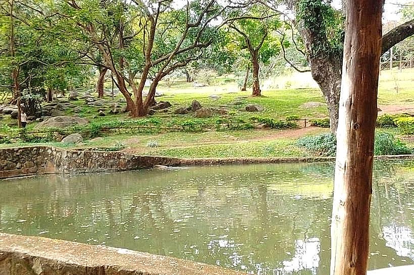
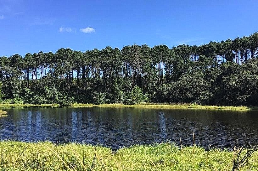
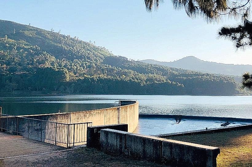
Mulunguzi Dam – A large, freshwater reservoir built in 2000 that serves as the primary water supply for Zomba city, offering tranquil lakeside picnic sites and an adjacent trout farm.
Infrastructure & Amenities
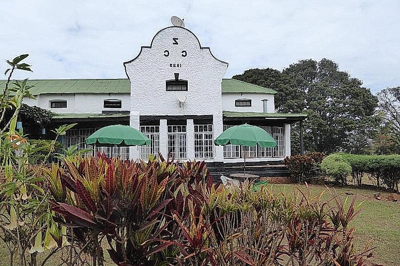
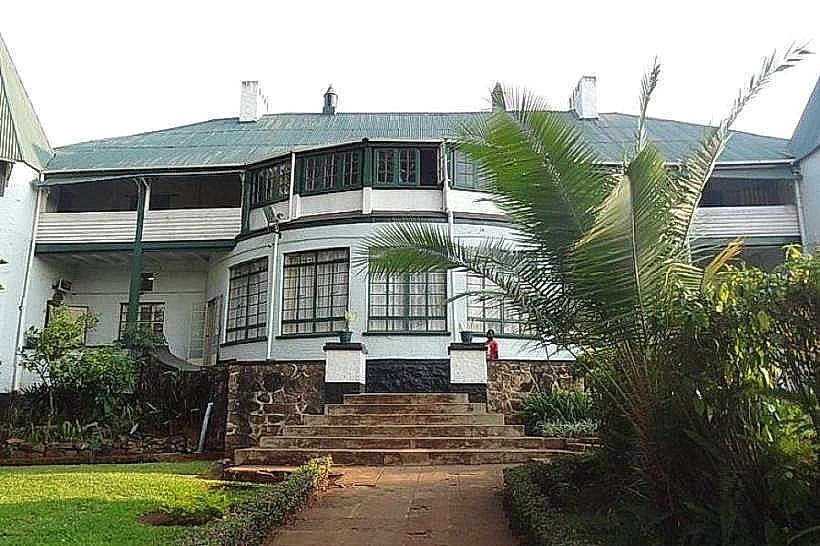
The plateau features highly developed tourism and civil infrastructure relative to other Malawian mountain zones. Premium accommodation is anchored by the Sunbird Ku Chawe Inn, a luxury hotel perched directly on the sheer edge of the southern cliff rim, complemented by the rustic, off-the-grid Zomba Forest Lodge and self-catering facilities at Chawani Bungalow. Permanent public restroom installations and manicured campsites are maintained near the central forestry office and the Mulunguzi picnic zones. Mobile cellular network connectivity is exceptionally strong across the southern facing rims and central resort blocks, with stable 4G and 5G signals generated directly from municipal towers in Zomba city, though deep interior ravines experience localized signal drops. Full dining amenities are supplied continuously by the on-site hotel and lodge restaurants.
Best Time to Visit
The optimal period for hiking, mountain biking, and high-visibility landscape photography occurs during the cool, dry winter season from May to August, when ambient afternoon temperatures hover comfortably between 14 and 19 degrees Celsius and atmospheric dust is at its lowest. Morning hours between 07:00 and 10:00 are highly preferred for cliffside viewing to secure clear views before convective midday heat generates thick valley mists or cloud seas that can completely shroud the lookouts. The wet summer season from November to April stimulates lush green foliage and maximizes waterfall volumes, but introduces persistent mountain fogs and heavy downpours that can make clay paths slick.
Facts & Legends
The famous lookouts derive their names from historic twentieth-century state visits; Queen’s View commemorates the 1957 excursion by Queen Elizabeth II, while Emperor’s View honors the 1964 visit of Emperor Haile Selassie of Ethiopia, both of whom publicly praised the vistas as some of the most spectacular panoramas in the former British Empire. Local folklore surrounding Chingwe’s Hole holds that the deep, unexplored cavern was historically utilized by early traditional authorities as a execution site and burial pit for political dissidents and prisoners of war, with local guides noting that ancient oral traditions claimed the internal channels connected underground all the way to the base of the mountain.
Nearby Landmarks
Zomba Botanical Gardens – 4.2km South (at the mountain base)
University of Malawi (Chancellor College) – 5.0km South
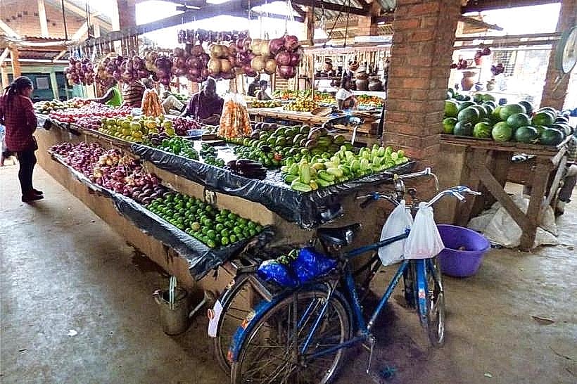
Zomba Central Market – 5.5km South
Chiringa Plains Basin – 15.0km East
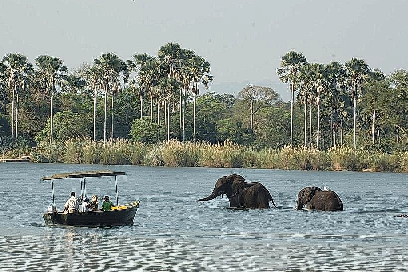
Liwonde National Park Southern Gate – 45.0km North