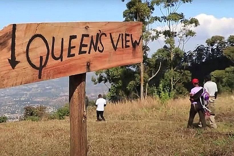
Landmark: Queen's View
City: Zomba
Country: Malawi
Continent: Africa
Queen's View, Zomba, Malawi, Africa
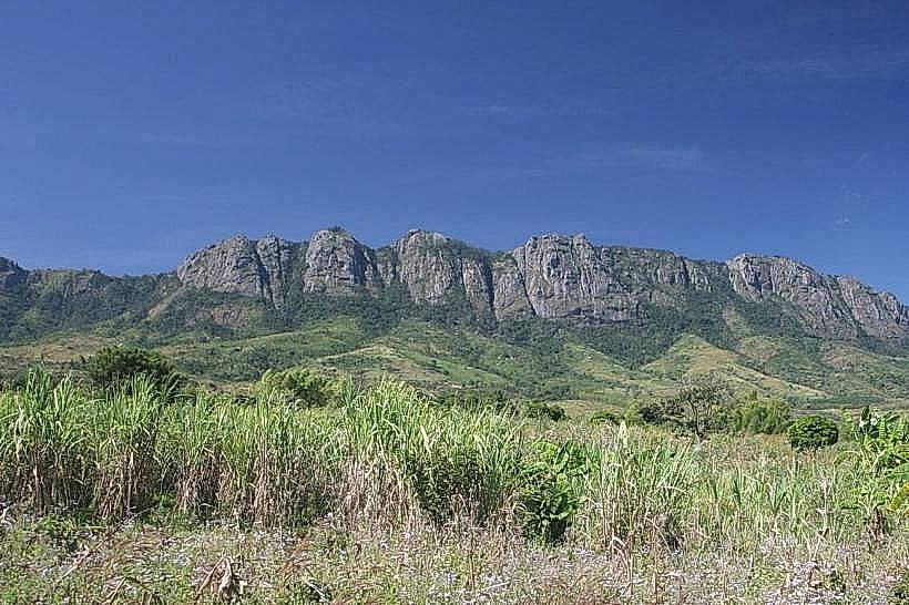
Queen's View is a famous cliffside vantage point, historical landmark, and panoramic destination situated on the upper southeastern edge of the Zomba-plateau_zomba" class="underline">Zomba Plateau. Located within the state-protected Zomba Forest Reserve in Southern Malawi, the lookout stands alongside the adjacent Emperor's View as one of the premier geographic observation decks in the Shire Highlands.
Visual Characteristics
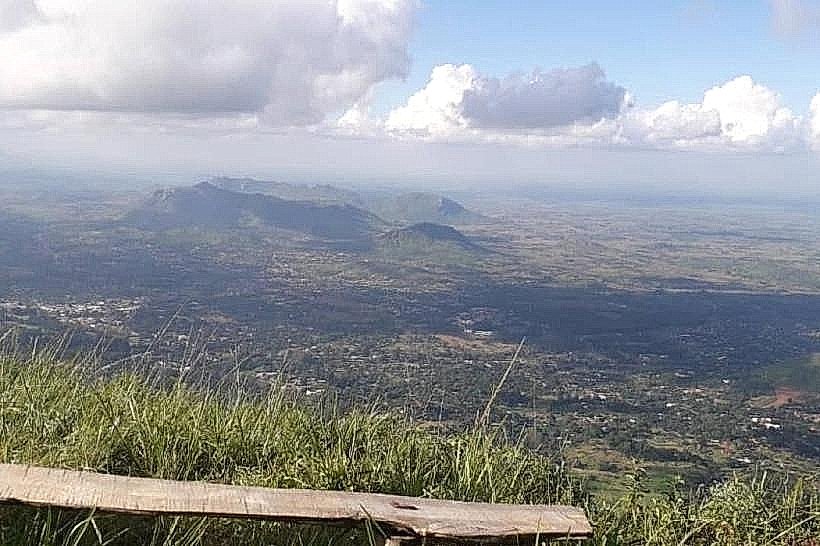
The landmark features a dramatic, near-vertical precipice that drops sharply down the eastern face of the massif, presenting exposed granite and syenite rock profiles. The immediate observation zone consists of a cleared earthen platform bordered by protective wooden barriers and weathered alpine scrub. The outward vantage point delivers an expansive, uninterrupted vista encompassing Zomba town directly below, the vast Phalombe Plains, the shallow waters of Lake Chilwa to the east, and the distant, towering silhouette of Mount Mulanje rising abruptly along the horizon line.
Location & Access Logistics
The lookout is positioned on the eastern rim of the plateau top, approximately 4.5 kilometers east-northeast of the Sunbird Ku Chawe Inn and 1.2 kilometers south of Emperor's View. Private vehicles approach from Zomba city via the paved Up Road, transitioning onto the unpaved, one-way gravel and clay forestry tracks that form the upper loop system across the plateau. A small dirt clearing borders the site to serve as a rustic parking zone. Public transit users must secure a private taxi or motorcycle taxi from Zomba boma to navigate the winding mountain tracks. From the immediate vehicle clearing, the walking path to the edge of the cliff platform is flat and measures less than 20 meters.
Historical & Ecological Origin
The vantage point derives its name from Queen Elizabeth II, who visited the Nyasaland Protectorate during her 1957 tour of the Commonwealth. She was escorted to this specific eastern rim coordinates, where she publicly lauded the scale and visual grandeur of the Shire Highlands. Geologically, the overlook sits on the cracked outer edge of an ancient granitic pluton exposed by tectonic fracturing along the East African Rift System. The localized escarpment flora is dominated by resilient montane shrubs and wind-stunted pine trees that stabilize the thin topsoils against heavy rim winds.
Key Highlights & Activities
Landscape photography, geography tracing, and birdwatching form the primary public focus. Visitors commonly hike the scenic, low-intensity rim trail that connects Queen's View to Emperor's View, providing alternating angles of the plains below. The open sky above the sheer rock wall functions as an active thermal updraft zone, facilitating the tracking of large soaring birds of prey, including the augur buzzard, Lanner falcon, and African crowned eagle riding the wind currents along the mountain face.
Infrastructure & Amenities
The site operates as an unmanaged, low-intervention natural asset under the jurisdiction of the Department of Forestry. It lacks permanent visitor interpretation centers, commercial kiosks, sheltered pavilions, or public restroom facilities at the immediate viewpoint clearing. Limited natural shade is provided by scattered pine trees near the access loop, while the main observation deck remains fully exposed to the elements. Mobile telecommunications connectivity is strong and stable; due to its elevated, outward-facing trajectory looking directly over the urban centers below, the lookout receives clear 4G and 5G cellular network signals broadcast from municipal towers in Zomba city.
Best Time to Visit
The optimal period for visiting Queen's View and securing sharp landscape photography corresponds with the dry winter season from May to August, when ambient plateau temperatures range comfortably between 14 and 19 degrees Celsius and atmospheric dust is minimal. Morning hours between 07:00 and 10:00 are strictly preferred to capture clear sunlight illuminating the plain and to witness the morning "cloud sea" filling the lower valley before convective midday heat dissolves the mist. The wet summer season from November to April introduces heavy orographic downpours and thick mountain fogs that can reduce visibility to less than five meters, completely obscuring the panorama.
Facts & Legends
Local administrative history records that the wooden guardrail system at Queen's View was first installed by colonial forestry units specifically to secure the perimeter for the royal entourage in 1957, establishing a permanent structural boundary that has been maintained through subsequent timber updates. Regional folklore often connects the deep precipice below the view to early security measures; oral accounts claim that prior to the establishment of formal colonial administrative courts, the high eastern cliffs served as a major geographic reference marker for boundary demarcations between local chiefdoms traversing the Shire Highlands.
Nearby Landmarks
Emperor’s View Cliff Overlook – 1.2km North
Mulunguzi River Nature Trail Head – 2.4km West-Southwest
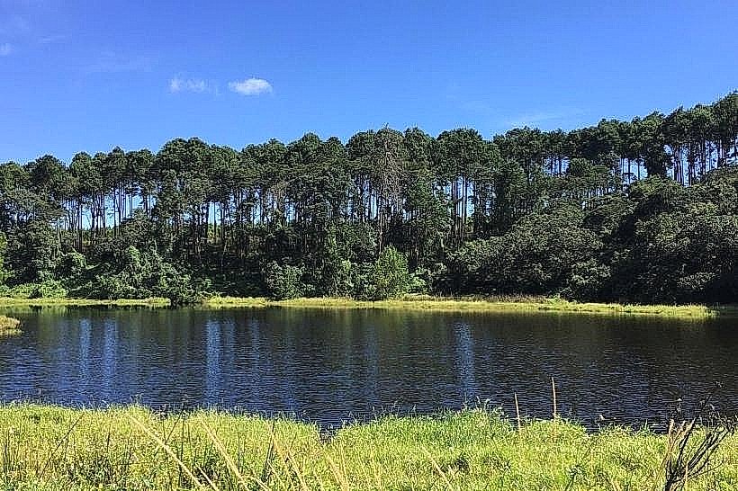
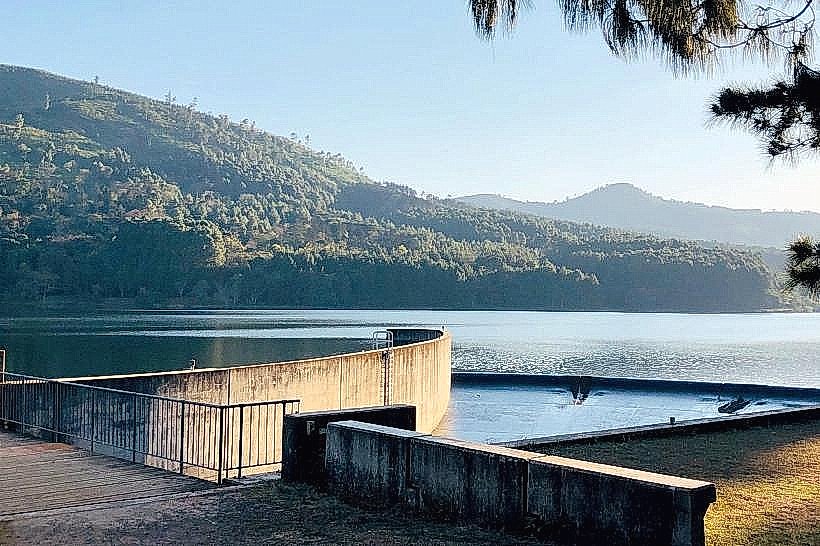
Mulunguzi Dam Reservoir Rim – 2.8km West-Southwest
Sunbird Ku Chawe Inn Cliff Edge – 4.5km West-Southwest
Chingwe’s Hole Sinkhole – 7.0km West-Northwest