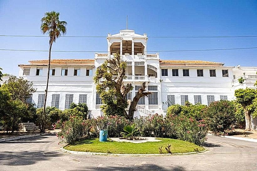
Landmark: Conseil Régional (Regional Assembly Building)
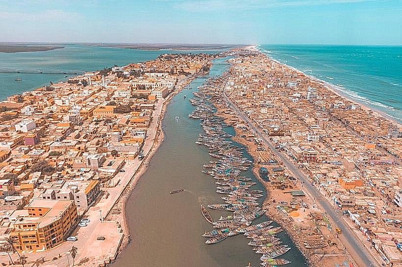
City: Saint Louis
Country: Senegal
Continent: Africa
Conseil Régional (Regional Assembly Building), Saint Louis, Senegal, Africa
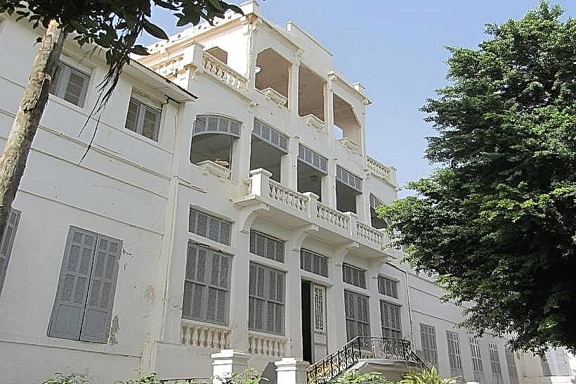
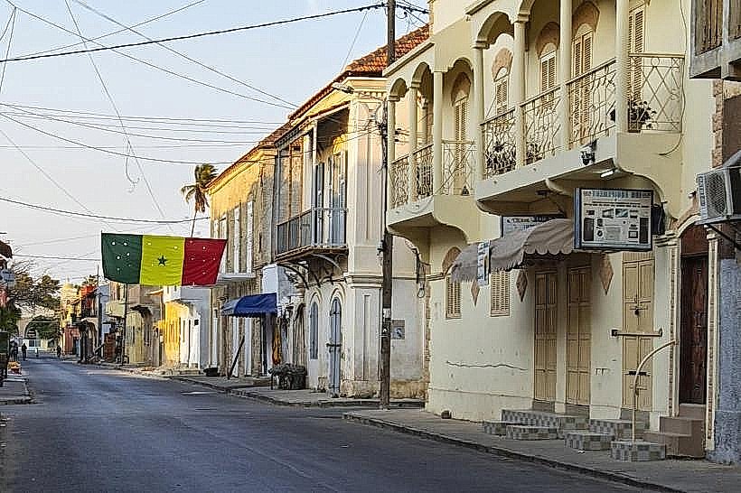
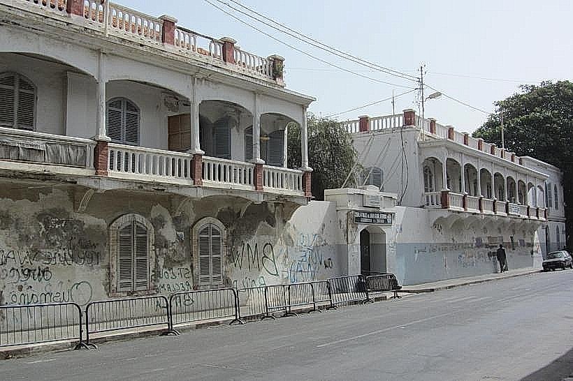
The Regional Assembly Building, also known as the Conseil Régional, is the primary administrative and legislative seat for the Saint-Louis Region in northern Senegal. It is situated on the northern half of the Île de Saint-Louis, within the UNESCO-protected historic district.
Visual Characteristics
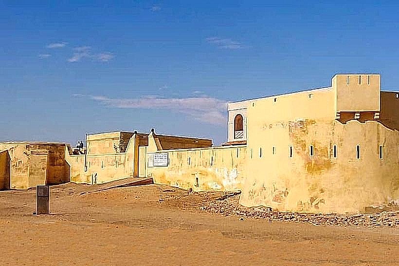
The building is a grand two-story colonial structure featuring a symmetrical facade and a prominent central entrance. The exterior is finished in a traditional ochre-yellow lime wash with contrasting white masonry detailing around the windows and doors. The architecture includes a series of arched ground-floor galleries, a second-story wooden veranda with decorative railings, and a red-tiled roof. The interior is organized around a central courtyard designed to facilitate natural airflow in the Sahelian climate.
Location & Access Logistics
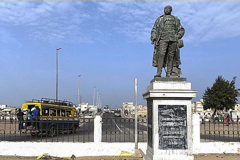
The assembly is located on Rue du Général de Gaulle, facing the Place Baya (formerly Place Faidherbe). It is approximately 0.2km north of the Faidherbe Bridge exit. Access is primarily on foot or via horse-drawn carriage through the island's central plaza. While no dedicated visitor parking exists, limited street parking is available along the river quays located 150 meters to the west. Local taxis from the mainland Sor district drop passengers at the bridgehead, a 3-minute walk from the building.
Historical & Ecological Origin
Constructed in the mid-19th century, the building originally served as part of the French colonial administrative complex when Saint-Louis was the capital of Senegal and French West Africa. It was designed to project institutional authority through neoclassical European proportions adapted to tropical conditions. The structure is built on the stable sandy silt of the island's northern plateau, reinforced by stone foundations to withstand the high humidity and salt air of the Senegal River estuary.
Key Highlights & Activities
The building functions as a working government office where regional legislative sessions are held. Visitors can observe the exterior colonial architecture and the ceremonial cannons positioned in the adjacent square. The surrounding plaza is the site of official military parades and the annual Saint-Louis Jazz Festival. While the interior offices are generally restricted, the public galleries are occasionally accessible during administrative events or cultural exhibitions.
Infrastructure & Amenities
The building is equipped with modern telecommunications, providing strong 4G and 5G cellular signals. There are no public restrooms inside for general tourists, but facilities are available in the nearby hotels and cafes surrounding the square. Shade is provided by the deep arched galleries and the large trees in the adjacent Place Baya. Several banks and ATMs are located within a 100-meter radius of the main entrance.
Best Time to Visit
The exterior is best viewed in the early morning (08:00 to 10:00) when the sun illuminates the eastern facade and the square is relatively quiet. For photography of the colonial details, the late afternoon provides a soft light that minimizes harsh shadows from the verandas. The building is most significant during national holidays (such as April 4th) when it serves as the backdrop for regional celebrations.
Facts & Legends
A historical oddity of the building is its role in the transition of power; it remained a center of governance even as the capital moved to Dakar in 1957, symbolizing the city's enduring status as the "cradle of Senegalese administration." A local tip is to view the building from the northern end of Place Baya to see how its proportions were designed to align perfectly with the Governor's Palace located directly across the square.
Nearby Landmarks
Gouvernance (Governor's Palace) – 0.1km North
Cathedral of Saint-Louis – 0.1km East
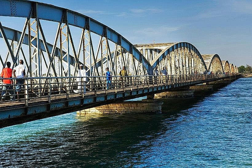
Faidherbe Bridge – 0.2km South
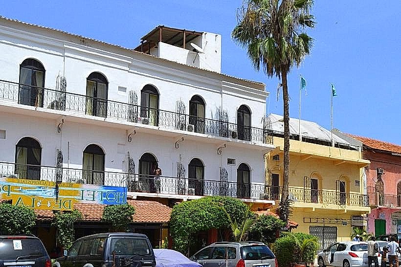
Hotel de la Poste – 0.2km South
Great Mosque of Saint-Louis – 0.3km North