Landmark: Ndar Island Historic District
City: Saint Louis
Country: Senegal
Continent: Africa
Ndar Island Historic District, Saint Louis, Senegal, Africa
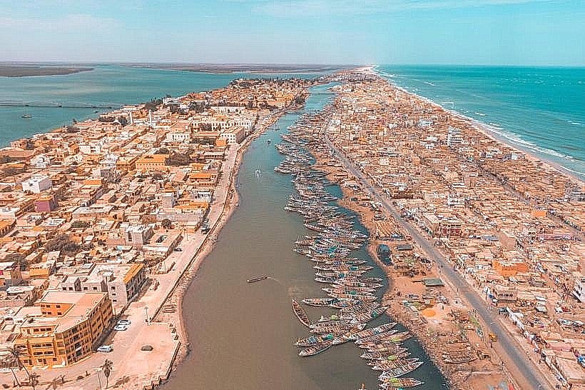
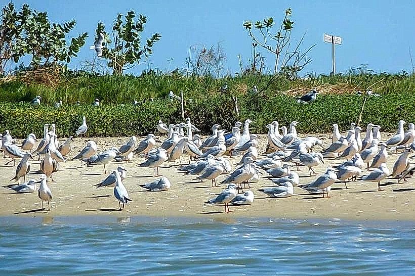
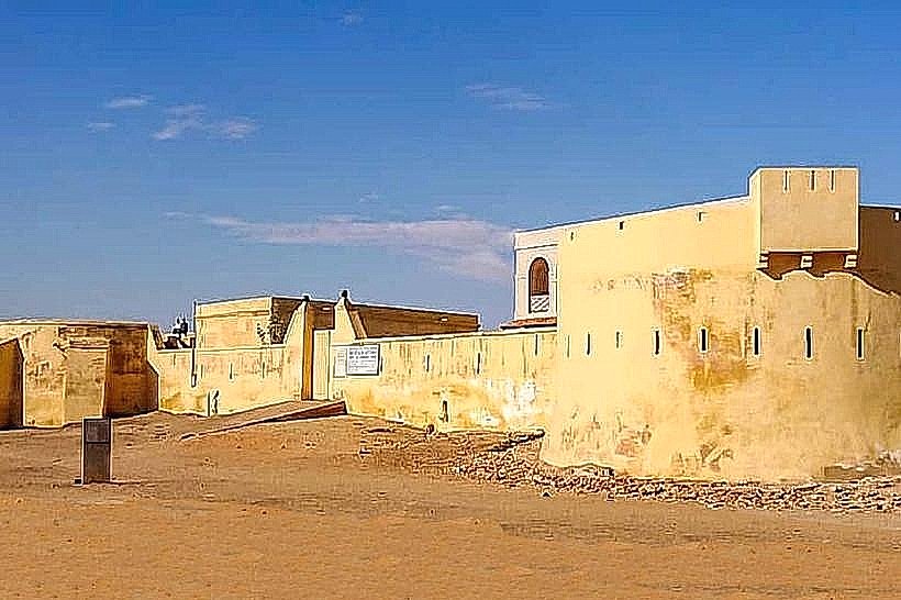
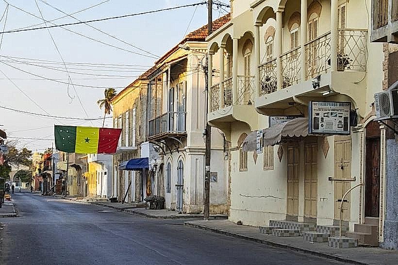
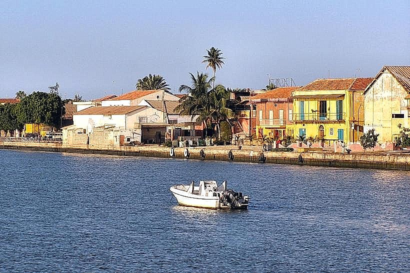
Ndar Island, or the Île de Saint-Louis, is a narrow landmass situated at the mouth of the Senegal River in northern Senegal. It constitutes the historical core of the city of Saint-Louis and is designated as a UNESCO World Heritage site due to its colonial urban planning and architecture.
Visual Characteristics
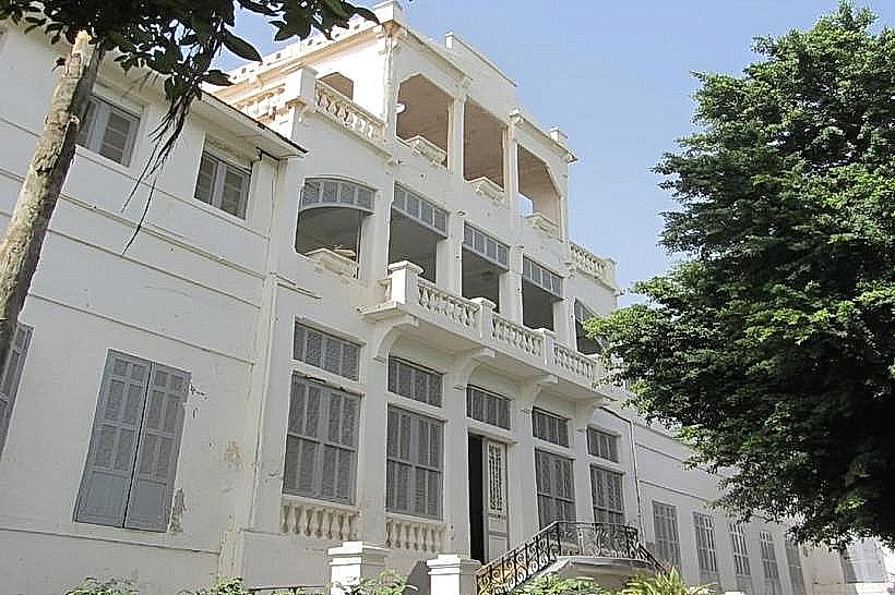
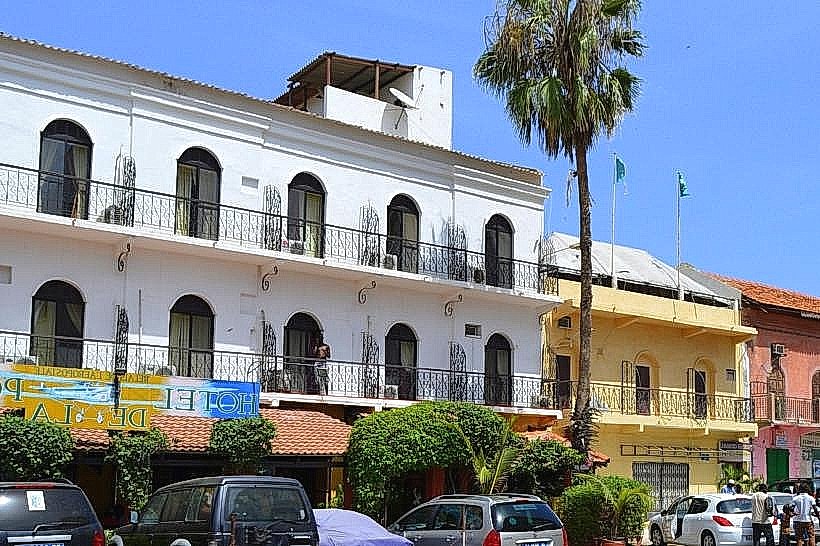
The district is defined by a 19th-century grid layout featuring two-story masonry buildings with thick walls, interior courtyards, and wooden balconies. Facades are typically painted in ochre, lime-wash yellow, or salmon pink with contrasting white or green shutters. The island is bordered by stone-reinforced quays, and the architecture includes "maisons à galerie" (gallery houses) with wrought-iron railings and clay-tile roofs.
Location & Access Logistics
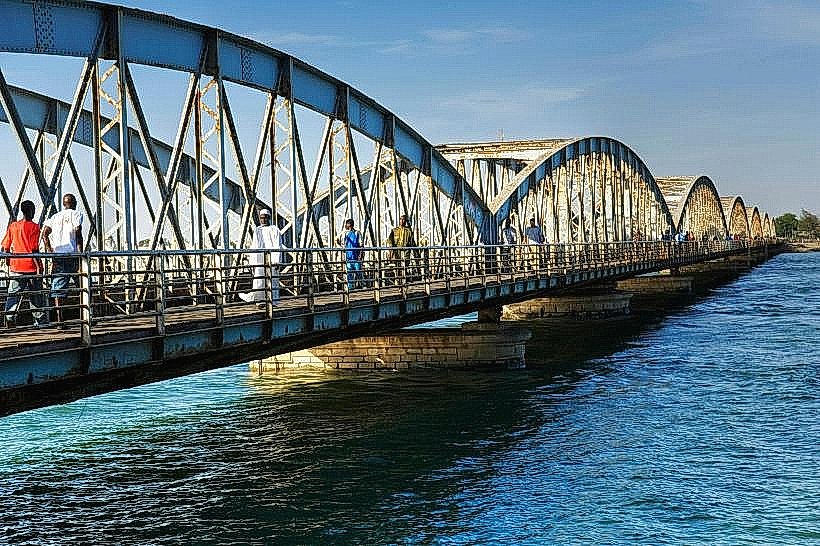
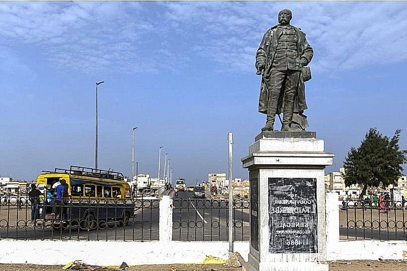
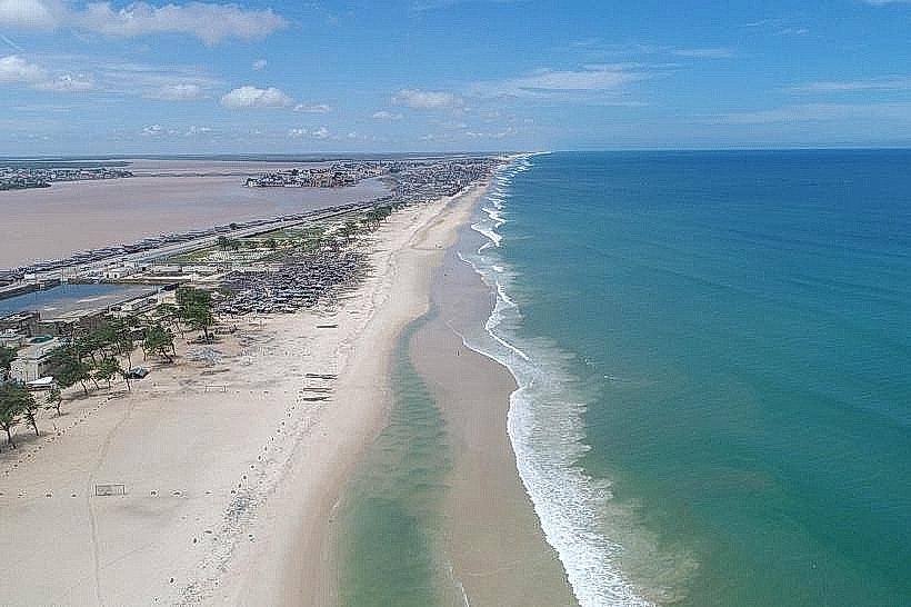
The island is positioned between the mainland (Sor) and the Langue de Barbarie peninsula. It is accessed from the east via the 507-meter Faidherbe Bridge. The district is approximately 2.5km long and 300m wide. Visitors can reach the island by foot, horse-drawn carriage (calèche), or taxi from the mainland Gare Routière de Sor. Motorized traffic is restricted in the narrower interior streets.
Historical & Ecological Origin
Founded as a French trading post in 1659, the island served as the capital of Senegal and French West Africa for nearly three centuries. It is an alluvial island formed by the accumulation of river silt at the estuarine meeting point of the Senegal River and the Atlantic Ocean. The urban form was codified in the mid-1800s to support the trade of gum arabic, textiles, and gold.
Key Highlights & Activities
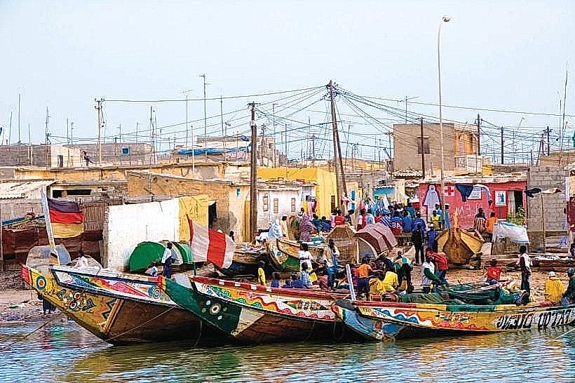
Visitors can conduct architectural walking tours through the North and South quarters to observe colonial landmarks. Specific activities include viewing the permanent collections at the Museum of Photography and the CRDS Museum. The western quay provides a site for observing traditional fishing pirogues navigating the river. The central square often hosts communal gatherings and cultural festivals.
Infrastructure & Amenities
The district contains a high density of boutique hotels, guesthouses, and restaurants. There are no public restrooms on the streets, but facilities are available within museums and hospitality establishments. 4G and 5G cellular signals are consistent throughout the island. Shade is provided by the narrow street corridors and the balconies of historic buildings. Banks and pharmacies are concentrated near the central administrative buildings.
Best Time to Visit
The optimal period for weather is the dry season from November to June. For photography, the late afternoon (16:30 to 18:30) provides the best lighting for the ochre-colored facades along the western waterfront. The island is most active in the early morning before the midday heat and again in the evening when temperatures drop.
Facts & Legends
The island is famous for the history of the "Signares," wealthy women of mixed African and European heritage who controlled the local economy in the 18th and 19th centuries. A specific tip is to visit the southern tip of the island, where the convergence of the river and the sea creates a distinct microclimate with constant Atlantic breezes.
Nearby Landmarks
Faidherbe Bridge – 0.1km East
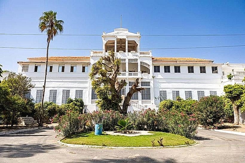
Gouvernance (Governor's Palace) – 0.2km North
Hotel de la Poste – 0.1km South
CRDS Museum – 1.0km South
Great Mosque of Saint-Louis – 0.4km North