Landmark: Gandiol Lagoon
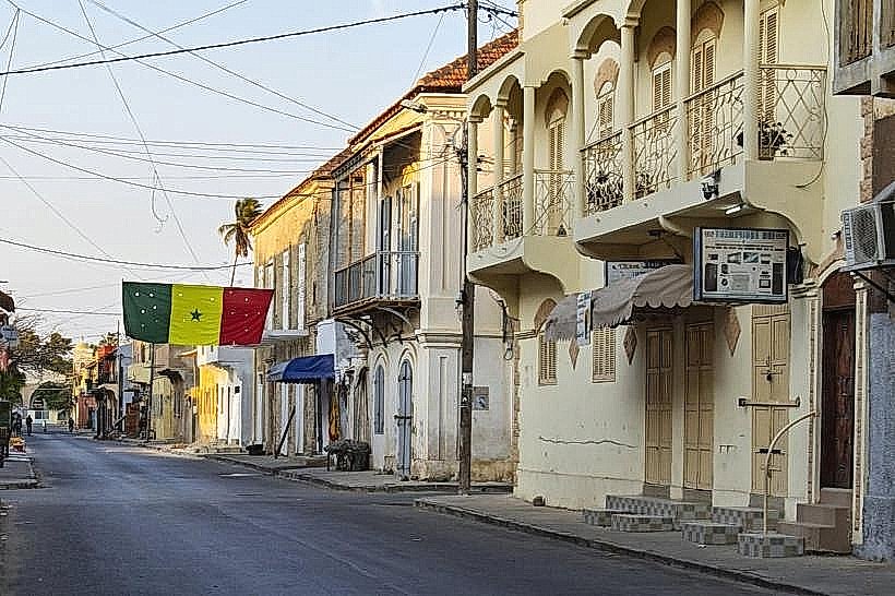
City: Saint Louis
Country: Senegal
Continent: Africa
Gandiol Lagoon, Saint Louis, Senegal, Africa
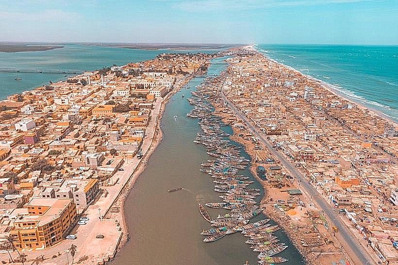
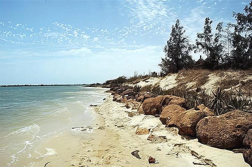
The Gandiol Lagoon is a shallow estuarine body of water located in the Saint-Louis Region of northern Senegal, at the southern terminus of the Langue de Barbarie peninsula. It serves as a critical transition zone where the Senegal River meets the Atlantic Ocean, facilitating a complex exchange of fresh and salt water.
Visual Characteristics
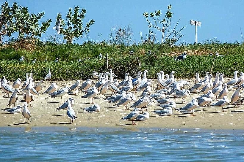
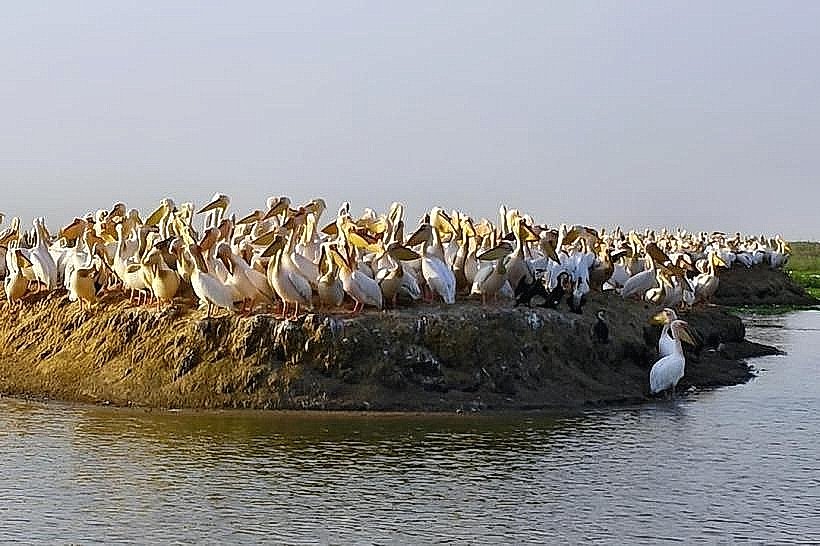
The lagoon is characterized by calm, brackish waters that vary in color from silty green to deep blue depending on tidal influence. The shoreline is dominated by extensive mangrove forests (Avicennia and Rhizophora species) and salt marshes. During low tide, vast mudflats are exposed, attracting high concentrations of waterfowl. The surrounding landscape is a mix of sandy dunes and small islands populated by nesting birds.
Location & Access Logistics
The lagoon is situated approximately 20km south of the city of Saint-Louis. Access is primarily via the N2 highway toward Louga, followed by a westward turn toward the village of Gandiol. From the village, the lagoon is reached by unpaved sandy tracks suitable for 4x4 vehicles. Boat transfers are necessary to explore the interior of the lagoon or to reach the Langue de Barbarie National Park, which forms the lagoon's western boundary.
Historical & Ecological Origin
Ecologically, the lagoon is a RAMSAR site and a core component of the Langue de Barbarie National Park, established in 1976. It was formed by the natural southward migration of the Senegal River's mouth. In 2003, a man-made breach was cut in the peninsula to prevent flooding in Saint-Louis, which significantly altered the lagoon's salinity and tidal patterns. This event accelerated coastal erosion and changed the local mangrove distribution.
Key Highlights & Activities
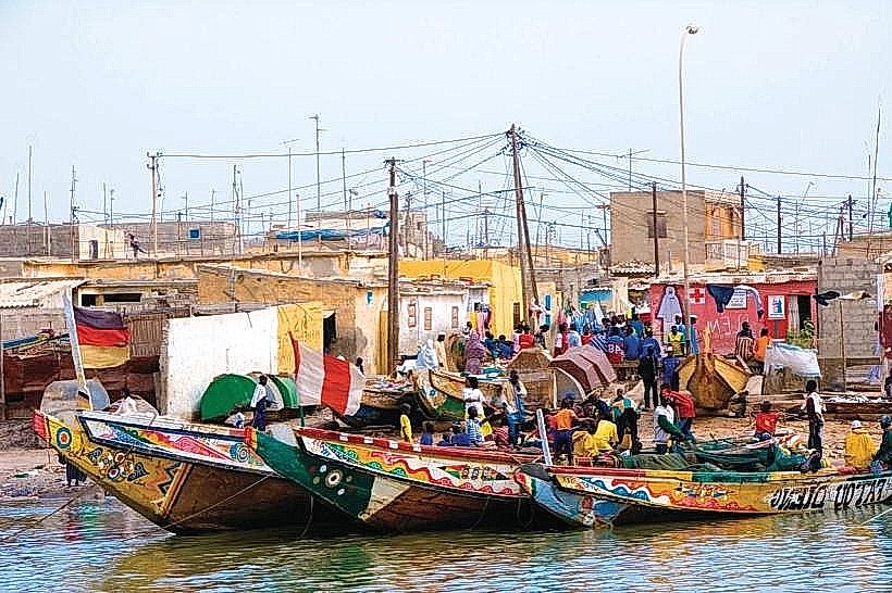
Specific activities include birdwatching, as the lagoon is a major wintering ground for migratory species such as flamingos, pelicans, and terns. Pirogue (traditional boat) tours are the primary method for navigating the mangrove channels. Artisanal fishing for mullet and shrimp is a common sight, conducted by local villagers using traditional casting nets.
Infrastructure & Amenities
The lagoon is a protected natural area with limited formal infrastructure. Several eco-lodges and "campements" are located in the nearby village of Gandiol, providing basic restrooms and dining services. There are no public facilities or paved roads along the lagoon's immediate edge. 4G cellular signal is available but can be weak in the denser mangrove areas. Shade is provided primarily by the mangrove canopy or thatched shelters at the local lodges.
Best Time to Visit
The optimal time for wildlife viewing is between November and April, when migratory bird populations are at their peak. For photography, the early morning (07:00–09:00) offers calm water surfaces and the best light for bird sightings. During the rainy season (July–September), the lagoon expands significantly, and the increased freshwater flow from the river alters the water's clarity.
Facts & Legends
A local historical fact is that the lagoon's configuration has changed more in the last 20 years than in the previous century due to the 2003 breach. Local legend among the Gandiol fishermen suggests that the mangroves are protected by spirits, and traditional rules often dictate where and when fishing is permitted to ensure the "renewal" of the lagoon's resources.
Nearby Landmarks
Langue de Barbarie National Park – 0.5km West
Gandiol Village – 1.0km East
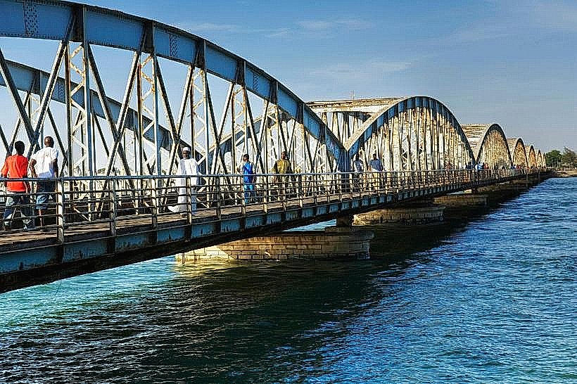
Hydrobase – 15.0km North
Senegal River Breach (The Cut) – 12.0km North
Makhana Pumping Station – 18.0km Northeast