Landmark: Senga Bay Beach
City: Lilongwe
Country: Malawi
Continent: Africa
Senga Bay Beach, Lilongwe, Malawi, Africa
Senga Bay Beach is an expansive lakeside shoreline and major artisanal fishing port located on the western coast of Lake Malawi. The landmark occupies the eastern tip of a broad peninsula in the Salima District, serving as the geographically closest beach destination to the national capital.
Visual Characteristics
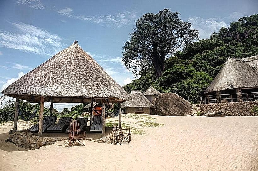
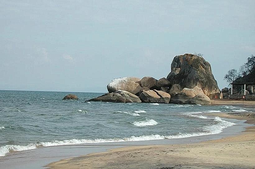
The beach landscape features a long, continuous crescent of fine, powdery golden sand that slopes gently into the clear, freshwater shallows of Lake Malawi. The aquatic profile is characterized by small, calm coves interspersed with smooth granite boulder formations that project directly into the water. Vegetation along the upper shoreline consists of scattered baobab trees, tall palms, and pockets of native reeds. The structural backdrop includes traditional timber-framed fishing racks used for drying catches, clusters of wooden dugout canoes parked on the sand, and low-rise stone and brick resort properties integrated discretely into the treeline.
Location & Access Logistics
The landmark is situated approximately 120 kilometers east of Lilongwe and 16 kilometers east of Salima town at the terminus of the S122 road. Private vehicles access the beach by driving east from Lilongwe along the paved M14 highway to the main Salima junction, continuing straight onto the S122 road through Salima town until reaching the waterfront. Dedicated paved parking is available within individual resort compounds, while informal sand parking clearings line the public access tracks. Public transport commuters can take an inter-city minibus from the Lilongwe bus station to Salima, transfer to a local minibus or shared taxi bound for Senga Bay, and disembark directly at the public beach entry points.
Historical & Ecological Origin
The bay has historically functioned for centuries as a vital socio-economic hub for indigenous Chewa and Yao fishing communities harvesting the lake's diverse aquatic resources. In the mid-twentieth century, the area underwent structural development to establish a regional lakeside resort destination, highlighted by the construction of the historic colonial-era Livingstonia Beach Hotel. Ecologically, the beach faces a hyper-diverse freshwater ecosystem; Lake Malawi holds a global classification as a biological hotspot containing over 1,000 species of cichlid fish, which evolved independently within the lake's distinct underwater rocky zones and sand beds.
Key Highlights & Activities
Swimming and sunbathing within the protected, low-current coves constitute the primary recreational activities along the shoreline. Snorkeling and boat excursions depart directly from the sand to explore the underwater rocky reefs around the nearby islands, allowing for the direct observation of colorful endemic mbuna cichlids. Visitors can observe the daily commercial routines of local fishermen launching large wooden boats at dusk or repairing nets on the sand during the morning hours. Kayaking, windsurfing, and guided cultural walks through the adjoining lakeside fishing villages are also common.
Infrastructure & Amenities
The public beach zones operate under a low-intervention framework with basic amenities, while adjacent private resorts provide modern restroom facilities, outdoor showers, and changing blocks for patrons. Natural shade is sparse on the open sands, requiring visitors to utilize the thatched palapas and shade trees managed by local hotels. Mobile network connectivity is excellent, with consistent 4G and 5G cellular signals available along the entire beach layout. Dining and beverage options are extensive, ranging from informal local fish-frying stalls on the perimeter to structured lakeside restaurants and bars operating inside the beachfront lodges.
Best Time to Visit
The ideal time for landscape photography and outdoor movement occurs during the early morning from 06:00 to 08:30, when the rising sun illuminates the eastern-facing bay and local fishing fleets return to shore with their catches. The most favorable weather conditions correspond with the dry winter season from May to August, when ambient temperatures remain comfortable between 21 and 25 degrees Celsius and southern winds are moderate. The wet summer season from November to April introduces high humidity, torrential afternoon downpours, and seasonal lake swells that can wash debris onto the sandy shoreline.
Facts & Legends
A distinctive local phenomenon involves the "lights of the lake" seen at night, when hundreds of artisanal fishermen illuminate small paraffin lamps or LED torches on their wooden boats across the dark waters of the bay to attract Usipa, a small endemic sardine-like fish, creating the structural illusion of a floating city along the horizon. Local folklore tells of ancient spiritual protective spots located among the large granite boulders at the northern edge of the bay, where community elders traditionally offered small gifts to ensure safe passage before navigating the unpredictable deep waters of the open lake.
Nearby Landmarks
Senga Hills Forest Reserve Boundary – 0.5km Northwest
Lizard Island Reef – 2.4km East
Salima Boma Administrative District – 16.0km West
Kuti Wildlife Reserve Entrance – 25.0km West
Marelli Islands Protected Group – 28.5km Southeast